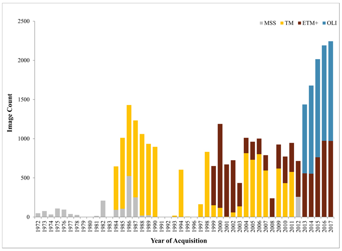
Fig.1. Total number of archived Landsat images acquired for Finland, by year and sensor. MSS = Multi-Spectral Scanner, TM = Thematic Mapper, ETM+ = Enhanced Thematic Mapper Plus, and OLI = Operational Land Imager.
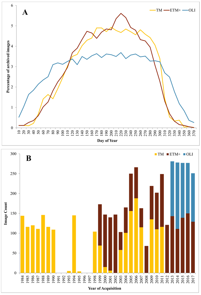
Fig. 2. Percentage of all archived Landsat images acquired for Finland and their acquisition day of year (A) as well as number of archived Landsat images acquired for Finland within ±30 days from the target day of year (August 1) and with cloud cover < 70%, by year and sensor (B). MSS = Multi-Spectral Scanner, TM = Thematic Mapper, ETM+ = Enhanced Thematic Mapper Plus, and OLI = Operational Land Imager..
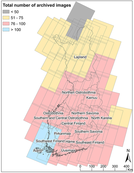
Fig. 3. Total number of images (1984–2017) for WRS-2 Landsat scenes covering Finland that were acquired within ±30 days from the target day of year (August 1) and <70% cloud cover, by Public Service Units of the Finnish Forest Centre.
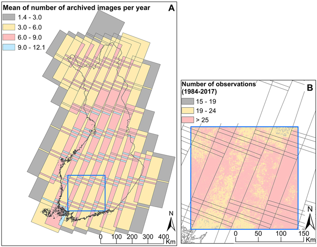
Fig. 4. Mean number of images (1984–2017) per year for WRS-2 Landsat scenes covering Finland that were acquired within ±30 days from the target day of year (August 1) and with <70% cloud cover (A). Realized number of observations (i.e. number of years with clear pixels for compositing) from best-available pixel (BAP) composites (1984–2017) for a sample area in southern Finland (B).